The measurement of ocean depth, known as bathymetry, is a critical aspect of marine science that helps in understanding oceanic features, ecosystems, and geological processes. Scientists employ a variety of sophisticated techniques to accurately gauge the depth of oceans, which can reach extreme depths, such as the Mariana Trench, over 10,900 meters deep. This article delves into the methodologies used in ocean depth measurement, the technological advancements that have emerged, and the significance of these measurements in various scientific domains.
Understanding Bathymetry
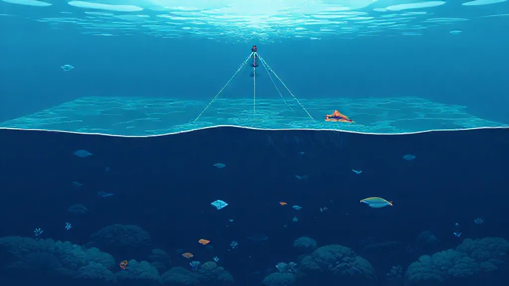
Bathymetry is the study of underwater depth and topography. It is essential for navigation, marine resource management, and environmental assessments. The earliest methods of measuring ocean depth involved simple lead lines, where a weighted rope was lowered into the water until it reached the seafloor.
This rudimentary technique provided limited data and was time-consuming. As technology advanced, so did the methods used to measure ocean depths, evolving into more precise and efficient techniques.
Echo Sounding: A Revolutionary Technique
One of the most significant advancements in measuring ocean depth is echo sounding.
This technique involves emitting sound waves from a ship or underwater vehicle that travel through the water, bounce off the seafloor, and return to the source. The time taken for the sound waves to return is measured, and using the speed of sound in water, scientists can calculate the depth. Modern echo sounders, known as multi-beam sonar systems, can map large areas of the seafloor with high resolution, providing detailed topographical maps that reveal underwater features like ridges, valleys, and mountains.
Satellite Altimetry: A Bird's Eye View
In addition to traditional methods, satellite altimetry has emerged as a powerful tool for measuring ocean depths on a global scale. Satellites equipped with radar altimeters measure the time it takes for radar signals to bounce off the ocean surface. By analyzing the variations in sea surface height, scientists can infer the underlying topography of the seafloor.
Although this method does not provide detailed local measurements, it offers a broad overview of ocean depths and can identify large-scale features such as mid-ocean ridges.
Submersibles and Autonomous Underwater Vehicles
For more in-depth exploration, scientists utilize submersibles and autonomous underwater vehicles (AUVs). These specialized vessels can descend to significant depths and are equipped with advanced sensors and imaging technology.
AUVs can conduct high-resolution surveys of the seafloor, capturing detailed data on underwater habitats and geological formations. This technology has revolutionized oceanographic research, allowing scientists to explore previously inaccessible areas.
The Role of Sonar Technology
Sonar technology plays a crucial role in measuring ocean depths.
Side-scan sonar, for instance, provides a detailed image of the seafloor by emitting sound waves at an angle. This technique is particularly useful for identifying shipwrecks, underwater structures, and marine habitats. By combining side-scan sonar data with multi-beam sonar, researchers can create comprehensive maps that enhance our understanding of oceanic environments.
Challenges in Ocean Depth Measurement
Despite advancements in technology, measuring ocean depths presents several challenges. The vastness and inaccessibility of the oceans make it difficult to obtain comprehensive data. Additionally, factors such as water temperature, salinity, and pressure can affect sound wave propagation, leading to inaccuracies in depth measurements.
Researchers are continually working to refine techniques and develop new technologies to overcome these challenges and improve the accuracy of ocean depth measurements.
Applications of Ocean Depth Measurements
The data obtained from measuring ocean depths has numerous applications. It aids in navigation, helps in the exploration of marine resources, and contributes to environmental monitoring and conservation efforts.
Understanding ocean topography is vital for predicting ocean currents, studying climate change, and managing fisheries. Furthermore, accurate bathymetric maps are essential for planning underwater construction projects and protecting marine ecosystems.
Future Perspectives in Bathymetry
As technology continues to evolve, the future of ocean depth measurement looks promising.
Advancements in machine learning and data analysis are expected to enhance the interpretation of bathymetric data, making it easier to identify patterns and anomalies. Ongoing collaborations between scientists, engineers, and marine researchers will further drive innovations in bathymetric techniques, ensuring that we continue to uncover the mysteries of the ocean depths.